Description
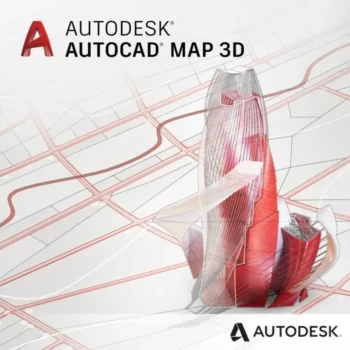
Autodesk AutoCAD Map 3D 1 Year Subscription 2025/2024/2023 PC/Mac | Genuine License
Autodesk AutoCAD Map 3D is a specialized design and mapping software solution, combining the power of AutoCAD with advanced Geographic Information System (GIS) tools to help professionals work with spatial data and create high-quality infrastructure designs. With this 1-year subscription for 2025/2024/2023 versions, you get access to the latest software features and updates, available for both PC and Mac platforms, with a genuine commercial license for professional use.
Key Features:
- Seamless GIS and CAD Integration: AutoCAD Map 3D allows you to combine the precision of AutoCAD’s drafting and design tools with GIS data, enabling you to integrate, manage, and visualize spatial information in a way that traditional CAD software cannot. Work directly with geospatial data alongside DWG files for comprehensive project management.
- Advanced Mapping Tools: Whether for creating utility maps, land use planning, or transportation systems, AutoCAD Map 3D comes equipped with powerful tools to manipulate, edit, and visualize geographic data like shapefiles, CAD drawings, and raster images, improving the efficiency of your workflow.
- 3D Visualization: Visualize geographic features and infrastructure in 3D to enhance your understanding of the terrain and designs. AutoCAD Map 3D’s 3D capabilities allow professionals to simulate real-world conditions, aiding in better decision-making for projects.
- Geospatial Data Management: Manage large datasets with ease, including precise spatial analysis, data editing, and real-time collaboration. Its data management tools help maintain the integrity of GIS data for accurate results.
- Flexible Platform Support: Available for PC and Mac, AutoCAD Map 3D ensures cross-platform compatibility for all types of users and teams, ensuring access to key features and tools, regardless of your operating system.
- Industry Standard Data Formats: AutoCAD Map 3D supports multiple formats, such as SHP, DXF, DWG, and KML, enabling you to work seamlessly with other GIS and CAD systems and share data efficiently with stakeholders.
- Cloud Collaboration: Take advantage of cloud-based features to collaborate in real-time with team members and clients. Share designs, data, and updates with ease, improving communication and streamlining workflows.
Benefits of the 1-Year Subscription:
- Access to Latest Features: Stay up-to-date with the latest advancements, tools, and functionalities introduced in the 2025/2024/2023 versions of AutoCAD Map 3D, ensuring that you are always using the most modern and feature-rich version.
- Continuous Software Updates: Enjoy seamless access to all software updates and improvements released during the year, ensuring your system remains current with the latest technological advancements in GIS and CAD.
- Enhanced Productivity: AutoCAD Map 3D automates several tasks related to data processing, spatial analysis, and map creation, saving time and reducing manual effort while improving design accuracy.
- Professional-Grade Tools: With AutoCAD Map 3D, gain access to professional-grade tools designed to streamline the process of creating and analyzing maps for urban planning, civil engineering, and infrastructure projects.
Ideal For:
- Civil Engineers and Urban Planners: Professionals working on infrastructure projects such as roads, utilities, and city planning will find AutoCAD Map 3D an invaluable tool for integrating GIS data with their designs.
- Geospatial Analysts: Use AutoCAD Map 3D to work with geospatial data and map out land uses, zoning, and other spatial elements to support planning, analysis, and decision-making.
- Environmental Engineers: Environmental projects benefit from the 3D visualization and spatial analysis tools in AutoCAD Map 3D, helping engineers manage and design infrastructure while considering environmental factors.
Why Choose Autodesk AutoCAD Map 3D 1-Year Subscription?
- Comprehensive Solution for Design & Mapping: AutoCAD Map 3D offers a unique blend of CAD and GIS tools that can handle both technical drawing and spatial data analysis in a single platform.
- Time-Saving Automation: The software includes tools for automating repetitive tasks such as data import, analysis, and mapping, significantly reducing the time spent on manual work.
- Flexible Cross-Platform Use: Whether you’re using a PC or Mac, AutoCAD Map 3D works seamlessly on both platforms, offering flexibility without compromising on functionality.
- Cloud Integration: Cloud-based features make it easy for teams to collaborate, share updates, and access data remotely, promoting better teamwork and communication.
- Genuine Commercial License: This genuine commercial license ensures compliance with industry standards, allowing for professional use in any business or commercial setting.
Conclusion:
The Autodesk AutoCAD Map 3D 1-Year Subscription offers a powerful suite of tools for managing, analyzing, and visualizing geospatial data, integrated with the robust drafting and design capabilities of AutoCAD. Available for both PC and Mac with a genuine commercial license, this subscription is ideal for professionals in civil engineering, urban planning, GIS analysis, and related industries. With continuous access to the latest updates, enhanced 3D visualization, and a wide range of data management features, AutoCAD Map 3D streamlines the design and mapping process, making it a must-have for anyone working with geographic data.





There are no reviews yet.